
reading time
2 minutes, 5 seconds
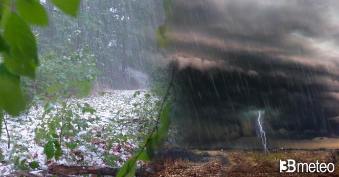
The weather has worsened again in northern Italy since late Saturday afternoon because of a disturbed front connected to a vortex low pressure descending from France. Showers and thunderstorms, localized but also of strong intensity, affected Piedmont, Lombardy and the Triveneto, extending between the evening and night also to Liguria, Emilia and Tuscany. Late in the evening a violent storm hit the city of Turin forcing the authorities to temporarily close the Turin Caselle airport.
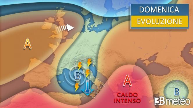
Now the minimum is located on the Ligurian Sea and still holds practically the entire North and Tuscany in check. The most intense phenomena since midnight occurred on Vicenza where they fell until 100mm of rain, almost 70mm in the province of Trento, 60mm in the Genoa area, 45mm in Varesotto, 40mm in the Cuneo area. Over the course of the day the low will not move significantly so we expect more a lot of instability on the central-northern regions with some openings that will begin to make their way starting from the Alpine sectors and the North-East. The small size of the low pressure will have no way of involving the rest of the Peninsula which will continue to rely on overall stable weather and sunny with a further decrease in temperatures in the South. Here is what is expected.
SUNDAY WEATHER: North, some openings on the western Alps and Friuli. Unstable or disturbed elsewhere with showers and thunderstorms, locally of strong intensity and associated with hailstorms and gusts of wind. During the afternoon, openings extended from the Alps to the Pre-Alps towards the plain sectors between Lombardy and Triveneto. Unstable weather will remain until the evening in lower Lombardy, Emilia and lower Piedmont. Center, unstable in Tuscany with showers and thunderstorms, locally of strong intensity and associated with hailstorms and gusts of wind. Between the afternoon and evening, thunderstorms also occurred between Umbria and Marche, isolated between internal Lazio and Abruzzo. South irregular cloud cover in Sardinia with some fleeting showers. Increasing clouds over Campania, Sicily and from the afternoon also Molise and Puglia. Occasional phenomena in the Campania and Molise Apennines, elsewhere mainly dry. Temperatures further decreasing. Winds Libeccio moderates on the north-western basins and northern moderates elsewhere. Rough or locally very rough seas
Do you have a webcam to report to us? In this specific section you can add it to our network >> Webcam.
Curiosity: in case of rain, is hot or cold air better for breaking glass? Here is the answer >> Here.


