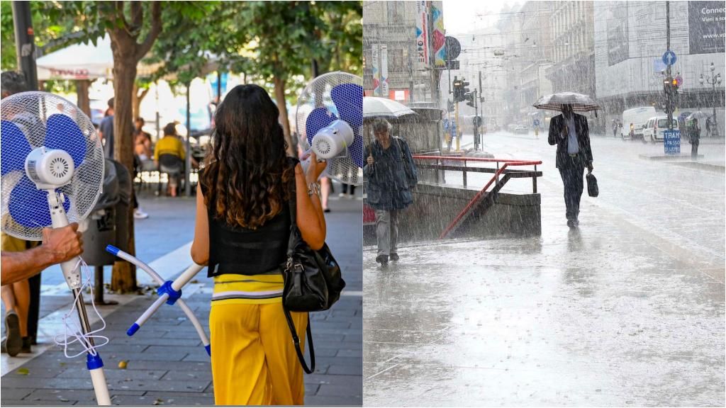
Milan, 27 June 2024 – Summer – autumn, round trip. In the next few hours the Lombardy we will enjoy a long-awaited (but limited) period of good weather: the vast area of low pressure responsible for the rains has moved towards the Balkansdetermining between today and tomorrow (Friday 28 June) the expansion of a North African promontory that will bring thermometers above 30 degreesin a general context of clear or partly cloudy skies. In the cities of Lombardy, after long days of bad weather and temperatures below the seasonal average, the heat will explode: Milan, for example, has been included among the 27 Italian cities with a yellow sticker. But be careful: on Saturday 29 June a new disturbance from France will cause showers and thunderstorms, also strong close to the Prealps, which will be a prelude to a phase of uncertain and at times rainy weather also for the start of the new week. Sunday weather It is expected to be uncertain everywhere but with a greater probability of rain in the Alps and Pre-Alps. The bad weather will not stop with the start of next week: new rainfall is likely on Monday in a context of marked variability. July will also open exactly as the month of June will close: with a summer that is slow in arriving.
Here they are forecasts by Arpa Lombardia day to day:
Tomorrow Friday June 28th
State of the sky: mostly clear or slightly cloudy skies across the entire region, local more significant clouds will be possible in the afternoon between the Alps and Pre-Alps. Precipitation: absent. Temperatures: minimum and maximum temperatures slightly and further increasing. Minimum values in the plains around 20 °C, maximum values around 32 °C. Thermal zero: around 4400 meters. Winds: weak or very weak in the plains with variable direction, weak westerly in the mountains with breezes in the valleys. Other phenomena: discomfort from strong heat on the southern plain, moderate elsewhere on the plain and in the low-altitude valleys.
Saturday 29 June
State of the sky: clear or slightly cloudy in the first part of the day, clear increase in clouds from the afternoon until cloudy to very cloudy skies in the evening. Precipitation: probable between the afternoon and evening in the western provinces, especially between the Alps and Pre-Alps, also in the form of showers and thunderstorms. Temperatures: minimum stationary, maximum stationary or slightly increasing. Thermal zero: around 4500 meters, decreasing since the evening. Winds: weak easterly in the plains; in the mountains from weak to moderate south-western at altitude, breezy in the valleys. Other phenomena: moderate to strong heat discomfort on the plain.
The comeback of the African anticyclone
The African anticyclone from Algeria moves back towards Italy and brings back the heat. with temperatures rising widely, sunny conditions almost everywhere for at least 4-5 days. “Temperatures will rise up to 42°C in Sicily, up to 35-36°C also in the center (Florence and Rome) with peaks of 34°C in the North” he explains Andrea Garbinato of the IlMeteo.it website. “In detail, after the extreme bad weather of the last few days the sun will also return to the North except for modest clusters in the Triveneto: isolated short showers cannot be ruled out on the Dolomite mountains, especially in the hottest hours of the day. Maximum temperatures will rise to 35°C on the Major Islands, 33°C in Puglia, 31-32°C also in the Centre-North. From Friday the heat will begin to get serious: maximum temperatures of up to 38°C are expected between Sardinia and Sicily, 35°C in Puglia and Campania, a muggy 34°C in the Padana Valley (Ferrara and Forlì), the same temperature but lower humidity also Rome and Terni. On this day, yellowish skies are expected over Sardinia for the arrival of the desert sand, but this coverage will not prevent the thermometer from rising significantly. The peak of the African anticyclone will be reached over the weekend with 42°C in Sicily, 40°C in Puglia (Bari and Foggia), 38°C also in Matera, with human ‘fever’ also at the Species Center on the Adriatic side: they are 37°C expected in Ascoli Piceno and Chieti. The capital will see a peak of 35°C, Florence 36°C on Saturday, Milan 32°C again on Saturday.
Violent disturbance in the North between Saturday and Sunday
Furthermore, we must report the passage of a violent disturbance over Central Europe between Saturday and Sunday: the tail end of this Atlantic front will also bring a rapid worsening to Northern Italy between Saturday afternoon and Sunday morning with thunderstorms, including strong ones, in the Alps; locally these storms may flow into the adjacent plains, with some moments of instability especially north of the Po river. Mainly, however, as mentioned, the African Anticyclone will dominate in the next few days with temperatures that locally will be 10°C higher than the averages for the period : after a capricious period, at times very disturbed with floods and tornadoeshere comes the Camel, as the subtropical anticyclone is defined in meteorological jargon.”


