
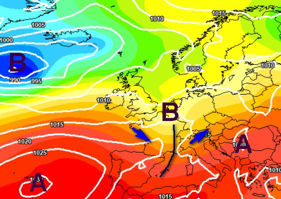

The double storm surge has been confirmed in the north between Friday and Sunday with possible reflections also in the center and south, especially on the Adriatic side. The mathematical models converge on a forecast of even violent thunderstorms in the north on Friday 21 June due to the insertion of the trough that will reach us from France, bringing air masses with clearly different temperatures into contact:
Above is the storm front expected on the afternoon of Friday 21 June in the north, but another trough is also expected between Saturday afternoon 22 and dawn on Sunday 23 June:
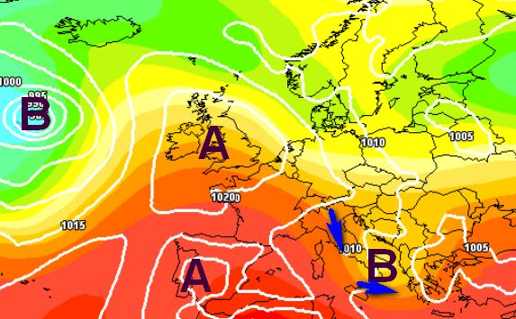
This trend line expressed by the American model, however, appears a bit extreme, the passage of the weekend trough could in fact be milder, limiting itself to producing further showers in the north, which would then descend along the Adriatic and in the extreme south between Sunday afternoon and dawn on Monday 24 June, as seen below:
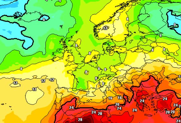
Even if the passage were mild on a thermal level, the cooling would still be important, as we see from this thermal map at 1500m scheduled for Sunday 23 June, with the cold air busy pushing the “African fire” towards the south:
However, thermal contrasts of this kind do not occur without the unleashing of violent thunderstorms, hailstorms and accompanied by gusts of wind spreading to the ground from the reversal of the cold air towards the ground induced by the showers (downburst). So pay attention above all to Friday 21st, when the energy at stake will be really great and the situation should not be underestimated.


