Calculating travel times in Google Maps: how it works – planetcellulare.it
This is how travel times are calculated on Google Maps within a route that we have to follow
More and more often we rely on Google Maps to move around the city or take our trips. The application shows great precision in indicating routes to individual streets or specific house numbers, often managing to illustrate routes that are as short as possible and above all very fast. A service which, however, involves a complex algorithmic calculation: let’s understand how it works.
Google Maps, how does it calculate the route we need to take?
Let’s say it openly: without Google Maps on many occasions we would have been destined to get lost in traffic. The application is increasingly entering our daily lives, becoming a lifeline for motorists and also pedestrians: how many tourists do we see using the service to get around the historic center of a city, but above all not to get lost in it? Many, if not most.
Google Maps is one of the most used services by the search engine, which in recent years has improved its functionality to guarantee us a professional and above all cutting-edge travel method: it is able to calculate routes through internal algorithms (road nodes), but above all predict the travel times of individual journeys and take into account the unknowns in real time (traffic, accidents, road closures, etc.).
How is the time of a road trip calculated?
Like many other digital applications, Google Maps also bases its services on artificial intelligence. In this case we are talking about technology Graph Neural Networks, better known to the more IT-savvy public as GNN. The route calculation for the application takes place systematically and above all with constant monitoring.
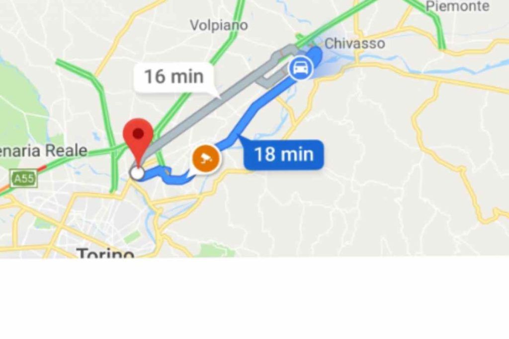
The stretch of road that we have to travel, for example from the Colosseum to St. Peter’s Basilica in Rome, is inserted into Google Maps. The application will tell us how in the car, between traffic and ZTL, it will take us approximately 13 minutes. On foot, on the contrary, around fifty minutes. How is all this calculated?
The entire route is divided into road junctions, parts of the route constantly monitored by Google Maps and which have a length of up to 100 metres. Each node in turn is made up of further “super nodes”, which allow the application to have a real-time view of what is happening along the road section we are about to tackle. Thanks to the use of GNN, not only is the application able to make a prediction on the times with which we will travel the route (calculating accidents or traffic), but also to make predictions on the times we will face if we make the journey in 10 or 20 minutes .


