reading time
2 minutes, 41 seconds
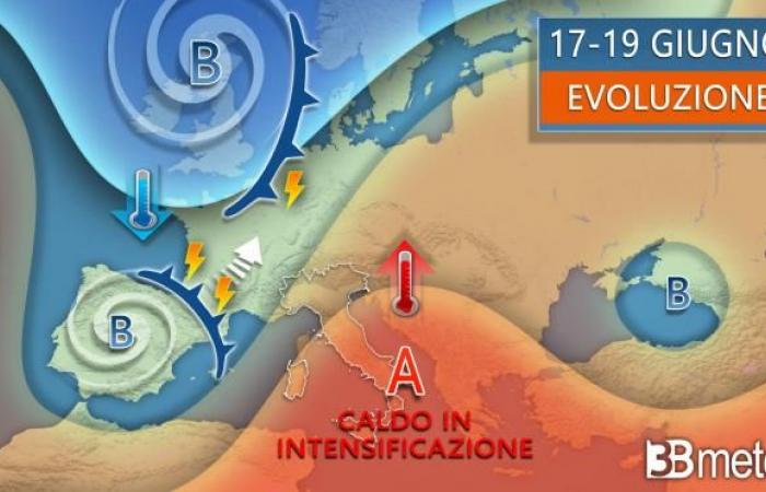
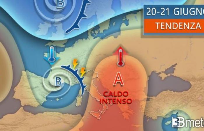
While one weak disturbance crosses the southern regions, the large one Atlantic sagging organized around the vortex over the United Kingdom, begins to point towards Western Europe. This change of circulation, which will bring strong bad weather in the next few days between Portugal, Spain and Francewill be the cause of rise towards the Mediterranean central and Italy of a massive anticyclonic promontory of African matrix. For our northern regions it will really change everything because we will go from strong storms and temperatures even slightly below average to split sunshine with abundant maximum values above average. For the Center and the South, which have not seen major unstable situations, the change in scenario will mainly be of type thermal. We will in fact have a significant increase in temperatures which in the middle of the week will be able to reach and locally even exceed the threshold of 40°C. The entire first part of the week will then be characterized by this escalation of heat the sacking in the Iberian sector it will begin to move towards France and a disturbance will reach northern Italy bringing the former strong thunderstorms. But let’s see how it should go.

Little to report on the day Monday with stable and largely sunny weather in Italy, except for a certain variability in the Alpine and pre-Alpine sectors with the possibility of a few blocks of rain, more likely in the central hours. The temperatures they will tend to be above average in the Centre-South and in part of the North.
The day of Tuesday will be characterized by even more stable weather. Sunshine expected everywhere in Italy except for one‘isolated diurnal variability in the Alps but associated with short and weak intensity phenomena. The temperatures will increase further.
Wednesday the powerful African comeback will be accompanied by a increase in veiling and the stratifications that will cross the sky of the Peninsula. In the juncture some thunderstorms it could start to touch the north-western Alpine and pre-Alpine sectors especially in the second part of the day. The temperatures will increase further and the threshold of 38/40°C may already be reached in some regions.

Thursday, day of summer solstice a first is expected unstable impulse which should bring thunderstorms between medium-high Piedmont and upper Lombardy, phenomena that could also be intense. Time would continue to hold stable elsewhere with few thickenings and the African heat which it will tend to achieve the apex. Maximum temperatures will be widely above 35/38°C with not uncommon peaks of 40°C or even higher in the Center and South.
Between Friday and Saturday Northern Italy could see a more incisive disturbed passage with showers and thunderstorms also strong intensity and a decrease in temperatures. Still stable and very warm weather in the central and southern regions, albeit with a drop in temperatures since Saturday. Even the day of Sunday it could be characterized by a certain instability which could also involve the Centre. The temperatures they would tend to go down a little further. The evolution from Friday to the weekend is still the subject of analyses and may present variations so we advise you to follow the updates in the coming days.
The concentration of pollutants in your area varies depending on current and forecasted weather conditions. To find out the pollution rate, consult our air quality maps, always updated >> Air quality.
Follow us on Google News


