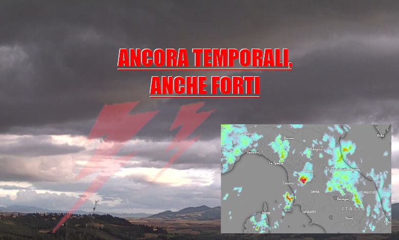
TUSCANY WEATHER STORMS. The minimum pressure centered on the seas off Tuscany is continuing to bring about repeated unstable phenomena.
After a “tired” phase during the early afternoon, new storm cells then formed in the Siena area, then moving north-north-west.
Currently a particularly active cell is moving from Valdelsa towards the Empoli plain heading towards Pontedera and Pisa.
Other cells are in action near the Piombino promontory, in the Arezzo area and on the Lungiana.
In the next few hours we still expect thunderstorms which will tend to move further north while a temporary break with clear spells will establish itself in the south.
MORE STORMS ON THE WAY.
Attention also tomorrow: Tuscany at risk of further thunderstorms, even widespread ones, which could take hold as early as late at night and then find new strength between the morning and the afternoon.
We therefore have a decidedly turbulent Monday ahead of us with numerous and repeated occasions for more bad weather, essentially thunderstorms.
Updates will follow shortly.
For all real-time reports, news and to send us your photos, subscribe to our official telegram group, we are waiting for you!
https://t.me/+1kcB3gY_R4QzNDhk
Or subscribe to the channel to always be informed!
https://t.me/meteotoscana


