Until Wednesday 26 June many regions of Italy will remain under the threat of a vortex full of bad weather which will continue to cause heavy rain, thunderstorms and storms.
After a period of intense heat and oppressive humidity that characterized much of the past week, weather conditions have undergone a radical change. A low pressure system, currently located between Corsica and the central Tyrrhenian coast, is bringing widespread instability to many areas, with effects that are expected to persist at least until mid-week, when the energy of the vortex will gradually run out.
That said, here it is between Tuesday 25th and Wednesday 26th June the atmosphere will still remain unstable, with locally intense storm phenomena and in some cases also accompanied by strong gusts of wind, abundant rainfall in the form of cloudbursts and hail. The areas most at risk will mainly be those in the Centre-North, while the South will still benefit from the protection offered by a high pressure area of African origin. A scenario of clear climatic division between the southern regions and the rest of the country is therefore emerging.
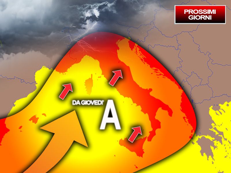
However, starting Thursday 27th, everything will change! A depression over France will cause a call of warm winds from North Africa which will fuel a new expansion of the African anticyclone towards Italy, which will be felt throughout the territory by Saturday 29 June. This will lead to a notable increase in temperatures, particularly evident on the larger islands: Sicily and Sardinia they will be the regions most affected by this heat wave, but the rest of the country will also enjoy more stable conditions and rising temperatures.
However, some areas of the North will be an exception, in particular the Alps, the Pre-Alps and the northernmost sectors of the Po Valley. In these areas, high pressure will be less active, thus being threatened by greater storm instability, with a consequent less warm climate.
If everything is confirmed, even the next week it will be characterized by a strong difference between North and South on the weather and climate front.
He also spoke on the topic of the next few days Antonio Sanòfounder of iLMeteo.it which we asked what should we expect in this final part of the month of June.
Already in these hours a “cold drop” descending from Northern Europe driven by cold and unstable air currents will manage to break through to our latitudes, giving rise to an insidious storm break after days of extreme heat. At high latitudes, currents flow (colder and unstable) that are very different from those that pass at lower latitudes (very warm and stable) and the heat exchanges between Northern and Southern Europe in particular conditions can evolve, in fact, into a drop cold, or in a block of cold air at high altitude that detaches from a larger Atlantic or Northern European depression. In short, an area of the atmosphere where it is much colder than all the surrounding areas. This nucleus, driven by unstable currents, tends to follow trajectories that are not always predictable and often takes a retrograde direction (from east to west). Temperatures will also decrease, bringing decidedly cooler values to the Centre-North.
Will we have to keep an umbrella handy again?
Absolutely yes! Between today and tomorrow, Tuesday 25 June, particular attention will need to be paid to the regions of the Centre-North and part of the Tyrrhenian sectors of the South: the fresh incoming currents could act as a trigger for the genesis of violent storms in these sectors, with high risk of hailstorms and local storms as unfortunately the recent news of recent years teaches us.
What will happen in the second part of the week?
The last storms are expected in the North and on the Adriatic coast on Wednesday 26 June: after the passage of the cyclonic vortex the pressure will increase again and the sub-tropical anticyclone will thus have the green light to gain ground on Italy once again. However, the high pressure does not seem so granitic: in fact, the possibility of storm breaks during the following weekend is not completely excluded, confirming a trend that has been going on for some time now, made up of very hot and stable periods alternating with fast , but incisive, stormy pauses.


