
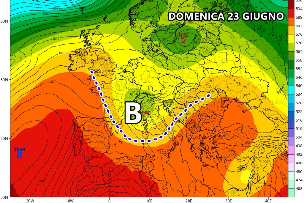

The first signs of a clear change in the time have manifested themselves in the last few hours Northespecially yesterday evening, when some strong storm caused storms and local hailstorms. The final change will arrive this weekend, when a fresh drop isolated at high altitude it will be able to invade the Mediterraneanwhere it will persist for several consecutive days.
The presence of this insidious drop offresh air isolated within the Mediterranean will cause several problems, i.e. the development of numerous temporal, especially in the central-northern regions, where we expect several days of strong instability. The temperatures they will certainly drop throughout the country, particularly in the North, but it is clear that this drop in temperatures will be followed by the arrival of thunderstorms, rain and local hailstorms.
Recall that these fresh cores at high altitudes surrounded by areas of high pressure often represent a big problem for forecasting centers. However, now that we are just a few hours away from its arrival, we can outline at least a definitive trajectory for this area low pressure. It will undoubtedly be the North to deal first with this fresh nucleus coming from the north-west: we expect a Sunday particularly turbulent with showers and thunderstorms, after which the phenomena will extend further up Tuscany, Marche And Umbria between Sunday afternoon and evening.
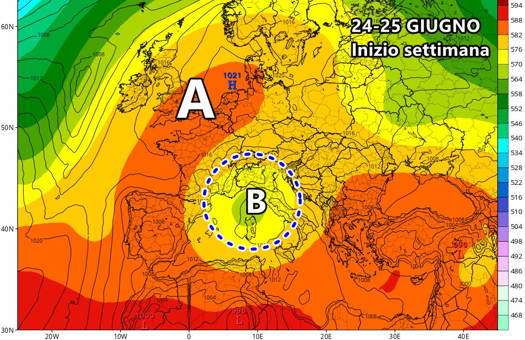
At the beginning of the week, the fresh core will settle on the Central-northern Tyrrhenian Seawhere he will give life to a low pressure stationary around which rather extensive storm fronts will rotate, which will mainly envelop the northern regions and a large part of the central ones. The most widespread phenomena are expected in Marche, Emilia Romagna, LombardyBass Veneto, Piedmont And Liguria. The South instead it will remain on the fringes of bad weather, while it will suffer a decidedly welcome drop in temperatures after the excessive heat of the last few days.
This fresh drop it will remain stuck on medium-high Tyrrhenian at least until mid-week, thus guaranteeing much more instability, mostly in the central-northern regions, with some rare appearances of showers also in the South.
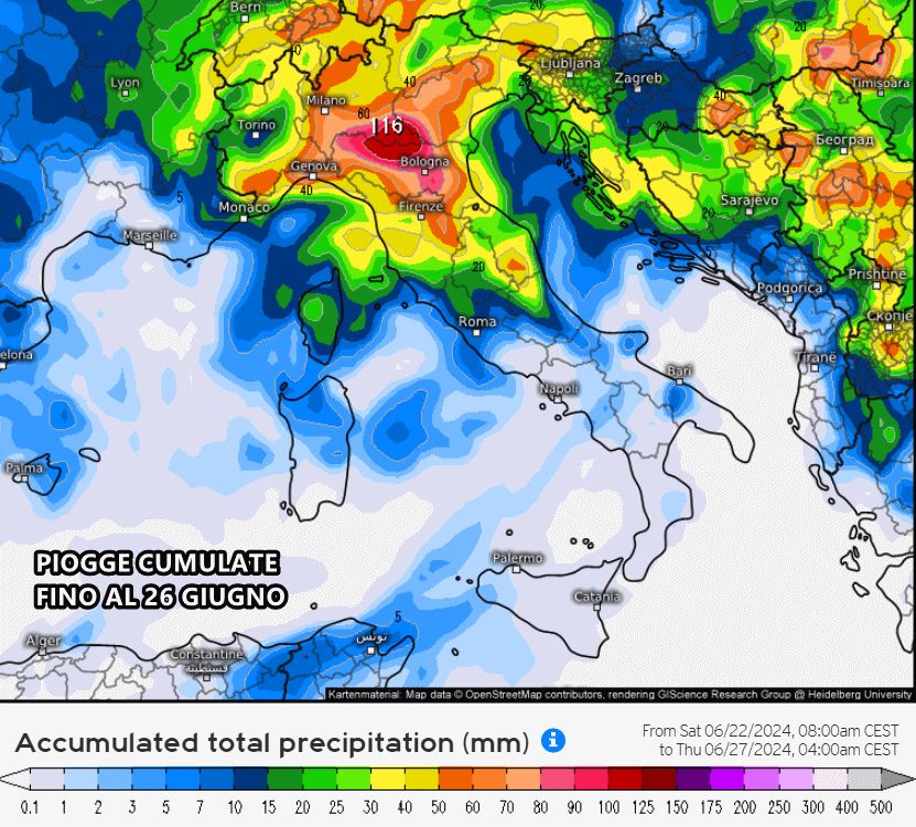
Below are the total rainfall forecast until June 26th from the American GFS model:
Between 26 and 27 June, this cool drop will tend to move away from Italy definitively, leaving room for a couple of days of stability and temperatures overall around the averages for the period.


