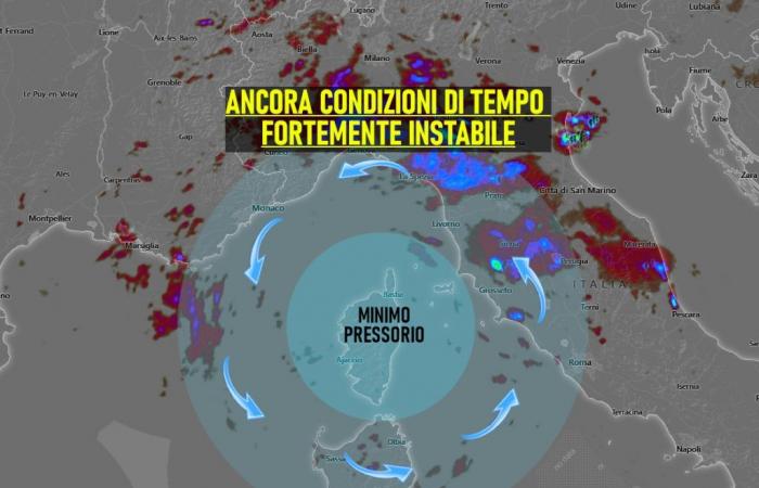
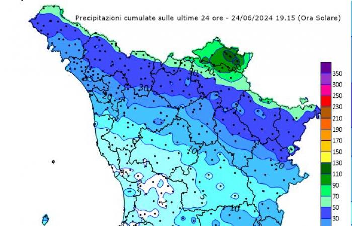
TUSCANY WEATHER. The effects of the cold drop at altitude which is moving little are still evident at the end of the day: thunderstorms between Argentario, Elba and Piombino, still heavy rains across the entire northern Apennines and a band of lighter rainfall in the central region .
It’s certainly not a normal early summer evening.
Returning to rainfall, as reported below, the accumulations of the last 24 hours are truly significant, especially on the Prato/Florentine part of the ridge: there is more than 100 millimeters of accumulation.
As we know, the situation is not yet destined to improve:
in the next night hours there will be more rain especially between the provinces of Massa Carrara and Lucca, partially attenuating during the late night.
From early morning there is the possibility of new light rain in the Grosseto area.
While already from the middle of the day, rapid development of multiple thunderstorm nuclei which will tend to affect a large part of the regional territory and may even be of strong intensity as already reported by the surveillance notice issued by the Civil Protection also for Tuscany.
So a Tuesday that will continue to keep the weather unstable and at times disturbed even in our Region, until the evening approaches.
TRENDING WEDNESDAY
The weather is still generally variable, while in the afternoon hours new cumulus formations will have to be taken into account, capable of bringing scattered thunderstorms which, however, will be less widespread and intense than those on Tuesday.
For all real-time reports, news and to send us your photos, subscribe to our official telegram group, we are waiting for you!
https://t.me/+1kcB3gY_R4QzNDhk
Or subscribe to the channel to always be informed!
https://t.me/meteotoscana


