The weekend which will close the month of June will begin with a day of Saturday 29 characterized above all by temperatures well above normalwith the sole exception of the Northwest where the values will be only slightly above the seasonal averages.
The very hot air within the high pressure extending from North Africa will in fact favor many peaks above 35 degrees especially in the Centre-South but with peaks even around 40 in the major islands. The central-southern regions will see widespread sunny weather; a few more clouds will be present in the Northeast and in the form of clouds over Sardinia.
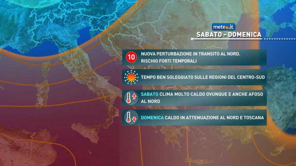
The North-West will record a new worsening during the day due to the arrival of the last disturbance of the month (no. 10): first showers in the morning near the western Alps followed in the second part of the day by the development of showers or thunderstorms over much of Piedmont and Lombardy with phenomena which, especially in the evening, could be strong with the risk of local storms, gusts of wind and hailstorms.
Sunday 30 the northern regions will see the after-effects of the disturbed passage in an attenuated form with some showers or isolated thunderstorms mostly concentrated in the Alpine sector; significant cloud cover associated with some rain may also persist in Liguria while more or less extensive clearings may occur in the Po Valley. In the rest of Italy the weather is still sunny. The ventilation will begin to become western starting from Liguria, Sardinia and part of the Tyrrhenian Sea with an influx of less hot air which will attenuate the most intense heat in the Northeast, in Tuscany, Umbria, Lazio and western Sardinia. On the Adriatic side of the Center and in the rest of the South again very intense heat with peaks close to 40 degreeseven beyond this threshold on Sicily.
July and the new week will then begin with the gradual arrival of the first disturbance of the month. It will be a front of fresher air entering the Mediterranean with intense Mistral winds which will have the merit within Wednesday 3 July Of dampen the heat bringing temperatures back to normal values even in the far South. Its transit will naturally be accompanied by a unstable phase with rain, including downpours or thunderstorms Monday 1st July in the Centre-North (especially between the North-East, inland and Adriatic areas of the Centre) and between the following night and Tuesday 2nd also in the peninsular South. For confirmation of this trend and further details, please refer to the updates in the coming days.


