Yesterday, Thursday 20 June, the Lombard Civil Protection launched an orange alert for strong thunderstorms which – in the Brescia area, starting from midday today – will particularly hit Valcamonica, the Pre-Alps and the large lakes. In correspondence with the most intense phenomena, we read in the warning note, “medium-large hailstorms and strong gusts of wind will be possible”. As a precaution, the Province has decided to close – again starting from 12:00 – the Sp 88 and the Sp 55, at the height of the landslides that occurred in Paspardo on 3 November 2023 and in Pertica Bassa last 25 May.
Possibility of supercells and flooding
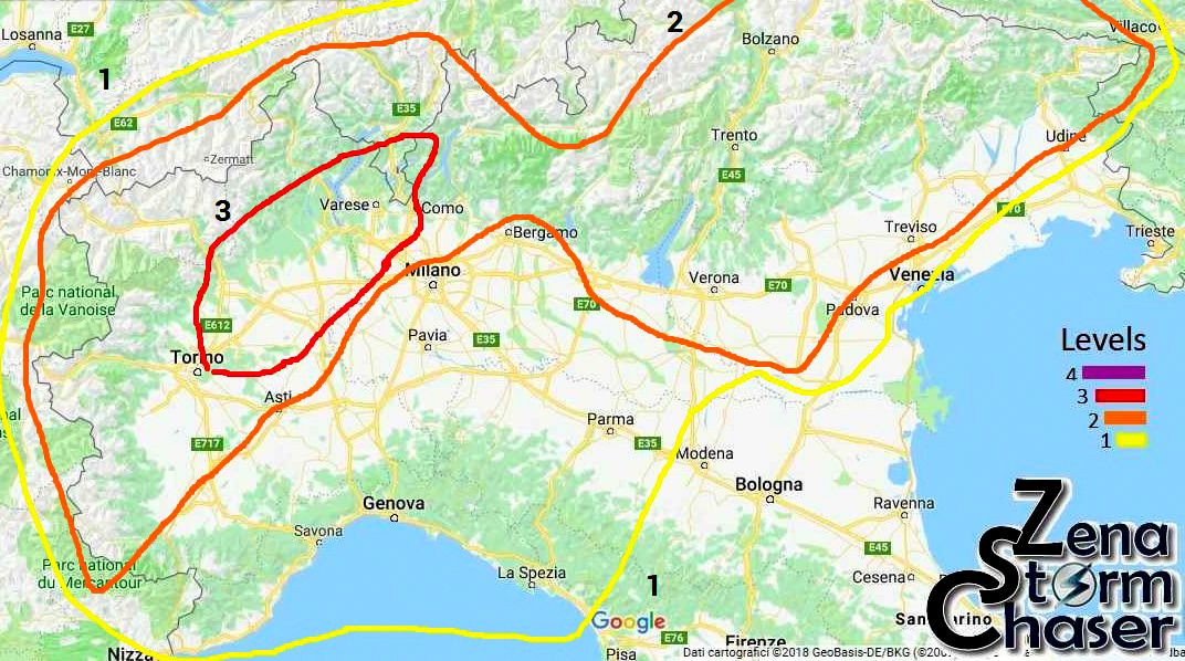
Not just storms, strong gusts of wind and risk of hail. According to Zenastormchaser.it, a group of experts specializing in extreme meteorological events, between today’s afternoon and evening “the cold part of the disturbance will reach the north-west, triggering new phenomena, this time even more intense, in Piedmont moving north- east, with the risk of medium-sized hail and the possibility of supercells” (levels 2 and 3 of the map below). Furthermore, meteorologists say that sudden floods will be possible “in the Alpine areas due to strong self-healing systems, driven by south-western ventilation”. The major alert, in our province, still seems to concern Valcamonica: all the weather reports agree on abundant accumulations of rain starting from mid-afternoon.


