Applause for the archaeologists and for the Superintendence official who answered numerous questions
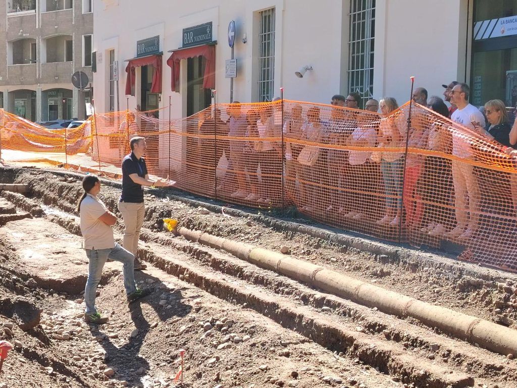
(mi-lorenteggio.com) Rho, 23 June 2024 – Over 360 people took part in the guided tours of the excavations in Piazza Visconti on the morning of Saturday 22 June 2024 which brought to light important archaeological finds. Welcomed by the Councilor for Culture, Environment and Infrastructure Valentina Giro, escorted by young people who are facing the Civil Service, the Rhodesians interested in learning about the findings and admiring the remains of the Roman road were divided into eight groups. From 9am to 1pm the archaeologists of the C&V Studio di Archeologia company Stefano Cervo, Francesca Capinera and Giulia Pasquini and the official of the Superintendency of Archaeology, Fine Arts and Landscape for the Metropolitan City of Milan Tommaso Quirino illustrated the value of these interventions in the area subject of one of the projects financed by the PNRR.
“This area will go from being an expanse of asphalt to a green square – explained councilor Valentina Giro – It is a project that has sustainability at its center to ensure that the city is more resilient by having urban spaces capable to resist moments of great heat, water bombs and particularly strong weather phenomena. The international architecture competition was won by the French landscape designer Michel Desvigne and his project includes a large central lawn area with trees to create a square flanked by a linear fountain that recalls the ancient stream, which once passed through here and it brought water to the town of Rho. We knew that we could find something ancient and for this reason preliminary surveys and excavations had been carried out, but finds emerged that we did not expect to find.”
“The relationship between public work and excavations began in advance, the legislation in fact allows preventive archeology procedures to be implemented: when a public work involves excavations, we carry out studies in the feasibility plan phase to understand if what we could finding underground could have impacts on the realization of the work – explained Tommaso Quirino – We examined the historical and archaeological information relating to Rho and the surrounding area to analyze as much as possible what is known so far. We did four surveys in what was previously a parking area. Three tested negative, in one case the well was found flanked by a section of masonry that can be seen behind the church. It was therefore estimated that something would probably come to light but that this would not prevent the realization of the work. However, it was important to request the presence of an archaeologist during all excavations carried out with mechanical means. Where we carried out preliminary surveys, a tank of a certain depth was built without major problems: some finds emerged, but they did not slow down the work. Another rainwater collection tank was built on the other side of the square without finding any finds. To build the pipes, trenches were dug and, during these excavations, remains of particular importance were found.”
Stefano Cervo went into detail: “We provided assistance during all the excavations. To date we have managed to identify elements that reveal the history of this section of the city, which appears to be the center of Rho, from Roman times until 1600, when Villa Visconti, today Villa Banfi, was built. The external fence closed the garden, we found two wells, remains of slaughtered and buried cattle, the remains of an ancient farm with signs of ploughing. We documented the early medieval phases by finding postholes that indicate the presence of a hut, probably oval in shape, made of wood and other perishable materials; this testifies that the area was also occupied in that historical period. We are currently examining the southern and eastern ranges, documenting a well, pillars and two phases of cobbled paving which probably pertained to the churchyard of the ancient church, then facing Piazza Visconti. The two streets identified have orthogonal orientations: east-west and north-south. Important roads because they are 8 to 10 meters wide, the oldest phase of which is certainly Roman: they are the main axes, Cardo Maximus and Decumanus Maximus”.
The road on the north-south axis is perfectly preserved and is under the area where the trees are present. The east-west axis, where excavation is underway, has already been largely removed by excavations for the laying of modern pipes: optical fibers, electricity lines, sewerage, gas. Parts of the road remain: four different levels are documented.
“We are excavating the most recent, medieval levels, but the oldest road dates back to the early or middle imperial age (1st-2nd century AD) – clarified Stefano Cervo – It is a road rebuilt several times but which continues to remain alive for long time. It is no coincidence that in the center of the city there is the villa of the lords of Rho: the Viscontis, when they arrived, placed themselves in the centre. And it is no coincidence that the church overlooked this square and not the other.”
What will happen soon? “We will dig and the Municipality will carry out the regeneration project – replied Tommaso Quirino for the Superintendence – Everything found will be scientifically documented, there will be a technical and photographic report. The desire to valorise is demonstrated by today’s visits: together with the Municipality we want to valorise what is happening and there will be public meetings to tell everyone about it. There will be publications and scientific studies that will involve experts in the sector because they cover a very broad time span. This part is excavated stratigraphically and the archaeological structures will be removed because they were already compromised by previous works, the best preserved north-south road, 8-10 meters wide, was not so deep: it will be possible to decide in the future how to enhance it with panels to tell its story presence and also look for some solution to make it visible. We are thinking of a sustainable solution because when an archaeological structure is brought to light and left exposed, its degradation begins. It has been preserved until today because it was underground, its necessary maintenance, if left exposed, inevitably involves a cost”.
Among the questions from citizens were questions about why the presence of these finds was not realized in the past. “In the past we had fewer protection tools even at a regulatory level – explained the official – probably at the time of those excavations the Superintendence and the Ministry were not addressed and there was no assistance during the works. When using an excavator you find layers of earth and layers of pebbles: distinguishing between natural and anthropic layers requires the presence of an archaeologist.”
Other Roman streets have much larger stones, why is this one made of cobblestones? “It is a glared road, that is, paved with gravel or finer layers. Elsewhere there are different pavements, but the value does not change”.
Isn’t it worth keeping the road in sight? “The preventive archeology procedures also guide the operational decisions to be made regarding the archaeological structures found, based on their typology and their different degree of conservation. We can completely excavate what we find to “reclaim” the area and allow the work to be carried out. If a structure is of particular interest, it can be dismantled and rebuilt elsewhere after the work is completed, perhaps in the same area where it was located. If the works do not affect the ancient structures, it may be decided to leave them underground to ensure their conservation. Of these different solutions, we adopt two here: where the road is particularly compromised we finish digging it and collecting all the information we can, the other stretch not affected either by previous or current works we keep underground and we have time to study possible valorization activities”.
The citizens have taken note of the fact that keeping fragments of ancient structures visible together with the trenches for the laying of optical fibre, electricity and gas would not make sense, also because those who are not used to recognizing in those cobblestones a road surface that is not would grasp its value.
Who will decide? “Everything underground is the property of the State – the archaeologists clarified – We have documented the structures and collected the finds and one day we will be able to find a solution to make the most of them and understand if and where to exhibit them. Each recovered element, from the horseshoe found next to one of the streets to the medieval well from 1200-1300, up to the perimeter walls of the villa from 1600, will serve to reconstruct the history of the square in different eras. All around the ancient nucleus of Rho, groups of necropolises from the Roman era were found at the end of the 19th and beginning of the 20th century, located outside the town and along the main roads. The orientations of these roads are also repeated in the surrounding territory which, again in Roman times, was divided into centuries that were used for agricultural exploitation. Other roads in Rhodes partly follow these same orientations. Also in the area of Piazza Visconti, among other things, a centurial canal 5 meters wide and 3 and a half meters deep was identified, which served to create these subdivisions of the countryside for agricultural and settlement purposes. This is further confirmation that those discovered were important roads, the main plot of this organization of the territory in Roman times. We need to understand when the first agricultural settlement was born and when the town developed”.
When will you finish the work? “We still don’t know what is between one layer and another – clarified Stefano Cervo – 1500 years are retraced in half a meter of stratification, the events are compressed into that layer of earth. It’s not easy to say how long it will take. We will try to maintain construction times because the PNRR funds have stringent deadlines, under penalty of losing the financing.”
On the part of councilor Giro, the advice to find out about local history by consulting the local documentation center and the anticipation of new studies: “We have some work to do, because a few things will have to be rewritten…”.
The Administration immediately evaluated the possibility of keeping part of the ancient road visible where the route is best preserved: we will proceed according to the indications of the Superintendence, guaranteeing continuity of the construction site. The Municipality of Rho thanks the experts together with HWSTYLE and Buzzi Scaviter, who guarantee the necessary assistance to archaeologists.


