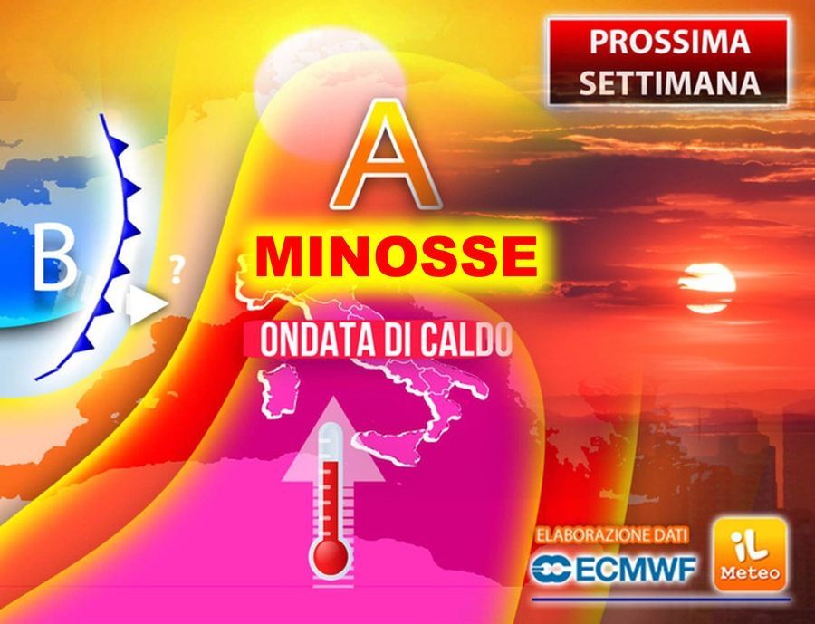
All confirmed: the African anticyclone from next week “Minos” will open the doors to Summer 2024.
In Dante’s mythology, a Minos the task of listening to the sins of souls is given, which hide nothing from the demon. Having heard their sins, Minos communicates their destination within hell, rolling his serpent’s tail in as many coils as there are circles of destination.
From a meteorological point of view it will show us the path that will lead to first serious heat wave generalized throughout Italy.
What causes this significant thermal increase (we are talking about values of approximately 8-10°C above the climatic averages expected in mid-June, especially in the Centre-South) will be humid and warm air masses of sub-tropical origin within the anticyclone arriving already at the start of the week (Monday 17 June) from Africa which, from inside the Sahara desert, will stretch towards the Mediterranean Sea. Tuesday 18 June the maximum temperatures will reach up to 38°C in Sicily and Sardinia (but not excluding local peaks of 41°C, such as in Perfugas and Mara in the Sassari area), 36°C in Benevento and Foggia but, for the first time in 2024, also 34°C in Rome, Florence and Frosinone.
The map below shows exactly the climatic anomaly during the key phase of this hot wave expected between Wednesday 19th and Thursday 20th (summer solstice), with color rose to indicate the hot bubble rising from the African continent towards the heart of Europe.
In short, Minos will bring hell to Italy, in the meantime let’s enjoy a pleasant weekend with decidedly cooler temperatures compared to those arriving next week.
These conditions will accompany us throughout the week across much of Italy with lots of sun and widespread heat like we haven’t seen in a long time.
Only the possible stormy break from Friday 21 June, when the anticyclone could be “pierced” by the arrival of fresh and unstable air currents descending from Northern Europe which would then interact with the very hot and humid air masses transported to the Mediterranean basin by the African anticyclone. Precisely in this one “nobody’s land” the greatest and most insidious contrasts occur: the heat and humidity that accumulate in the lower layers of the atmosphere (potential energy) increase the risk of extreme weather events such as storms And hailstorms.
However, given the still long time gap, we will have the opportunity to return to this in our next updates: for now there is room for the first serious heat wave across Italy.


