
The bad weather will return to vehemently hit the north and part of the center between this evening and Wednesday 26 June, but the most intense phenomena are expected between Sunday 23 and Monday 24, when real storms are expected starting from Lombardy and lower Piedmont, with possible initial involvement also of Liguria.
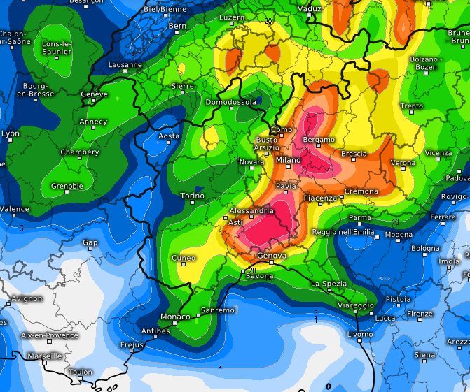
The maps of the American model speak clearly, the first refers to the expected phenomena between 6am and 6pm on Sunday: Milan, Pavia, Bergamo, Brescia, Alessandrino, among the most affected areas, with accumulations exceeding 40mm in a few hours:
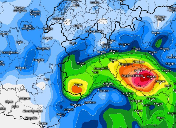
The phenomena will then gradually tend to localize in Emilia-Romagna and lower Piedmont, still involving lower Lombardy, as you can see from the next map, expected for the day of Monday 24 Juneheavy accumulations expected between Parma and Modena:
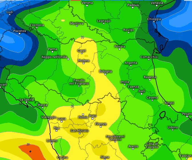
Between Monday evening and the early hours of Tuesday Tuscany, Emilia-Romagna and part of Veneto will experience the heaviest, albeit more attenuated, rainfall accumulations, with the San Miniato area particularly affected:
So be careful of flooding in underpasses, landslides and mudslides on mountain roads, avoid traveling under the storm, follow the updates.
