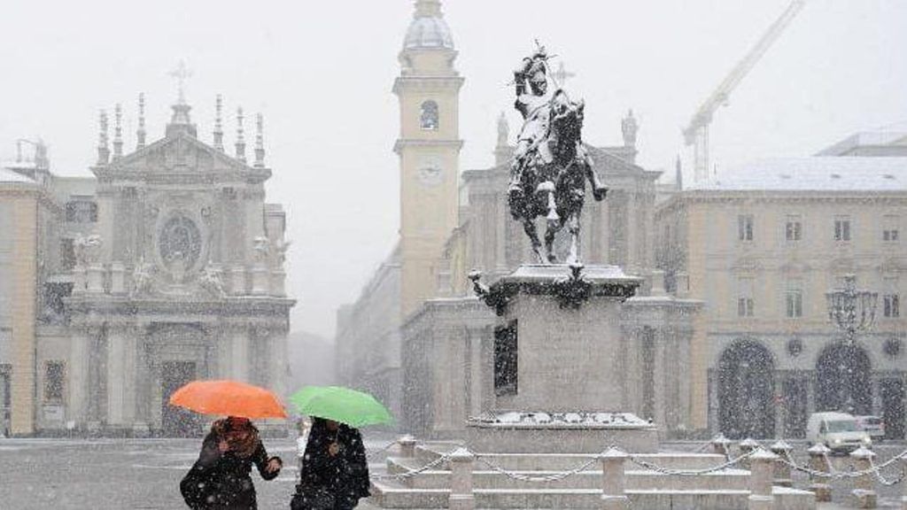
Radical change in the climate over Italy during this weekend. Already the crispest temperatures with a winter flavor have made their appearance over the last two days, but starting from this weekend and in particular from the beginning of next week, the cold will also be followed by a worsening of weather conditions with the arrival of a deep depression. In Piedmont, the combination of humidity and winter-like temperatures could create the conditions for snowfall at lowland levels, in particular in the Cuneo area, between Turin and Cuneo and in the Alessandria province leaning against the Apennines.
April snow in Molise, Capracotta whitewashed
Andrea Vuolo, expert meteorologist explains to us what the situation is and what is expected for the next few days. «Although with details obviously not yet understood, the possible disturbance from the winter characteristics arriving in Piedmont for the start of the new week is confirmed» he explains. And with it, in addition to the rain, “snow could return even at very low altitudes for the period”.
It snows on the Modena Apennines, 15 centimeters on the Radici Pass
The genesis of bad weather
The cold air of Arctic-maritime extraction which will be thrown again from the heart of continental Europe towards Northern Italy from Sunday afternoon-evening, combined with the influx of southern and eastern currents in the medium-lower layers of the troposphere, will give lead to widespread moderate precipitation and at times strong intensity in central-southern Piedmont, with possible heavy snowfalls in a good part of the Piedmontese Alpine range already from 600-800 meters and with sometimes significant accumulations (even over 30-40 centimeters above 1,000 -1,200 meters). «From the latest updates, however – explains Vuolo – the chances of a snowfall rising up to the hills on Monday between Turin, Cuneo, Asti and lower Alessandria, with flakes that could reach at times even near the plains of lower Piedmont, potentially whitewashing some localities in the plains and hills of the Cuneo area, including the city of Cuneo”.
[[(Video) Riale, il villaggio alpino isolato: tanta neve, sole e silenzio]]
Previous
«Obviously there are still a few days left to be able to go into further details and therefore, at least until tomorrow evening, there could be important changes to the forecast system. While waiting for confirmation, what is emerging could turn out to be one of the latest snowfalls (at LOW ALTITUDE, below 500-600 meters above sea level) in recent decades for our Piedmont. In the recent past, and in particular in 2016 and 2017, however, two events were remembered on the same date (1 May) with snow showers which accumulated several centimeters on the ground already from low mountain levels, but only above of 600-900 meters above sea level, also causing a lot of damage to the vegetation due to the significant accumulation of heavy snow on the plants” underlines Vuolo.
Episodes of spring snowfall are rare but have already happened in the past at low altitudes. For Turin the last snowfall with accumulation in the third ten days of April was on 04/25/1972, moreover the latest snowfall ever (with at least 1cm) even since the beginning of measurements, i.e. since 1787. In 1816 it snowed on May 1st for a few hours but without settling on the ground, during a thunderstorm with dynamics similar to 1787 and 1972. The last “big” late snowfall was on 17 April 1991 in the city. «But Turin – concludes Vuolo – should not be able to see snow with accumulation on Monday, in the hills above 350-400m it can do it!»


