
reading time
1 minute, 17 seconds
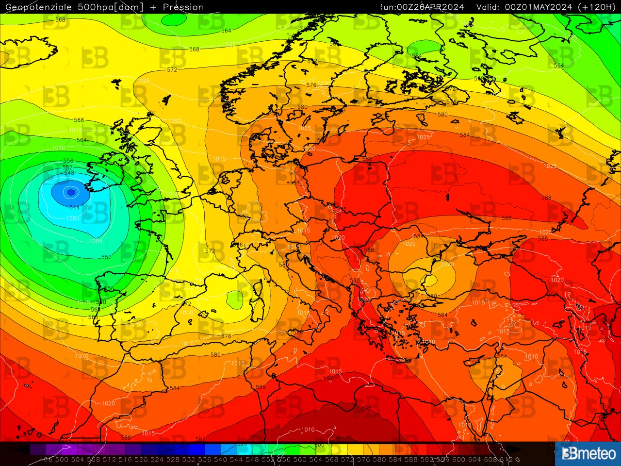
The anticyclonic comeback that will materialize already during the weekend will continue in the first days of next week, with the advancement of an Afro-Mediterranean high pressure field towards central-eastern Europe which will also affect Italy. Temperatures will already increase towards the end of the week and will gain further degrees until Tuesdayespecially in the Centre-South and the North-East, with values that will go a few degrees above the averages of the period, in particular in the Tyrrhenian regions. The context would be based on atmospheric stability over many regions thanks to the presence of the anticyclone, with the exception of some rain which may affect the Northwest and Sardinia, dictated by the influx of humid southern currents triggered by an Iberian depression.
This situation of prevailing atmospheric stability with a mild climate could begin to change from May 1st, when the same Iberian depression would advance in the Mediterranean area, also involving Italy. If the trend is confirmed next month it could start with an increase in instability starting from the western regions of the Boot, with rains and thunderstorms advancing towards the Adriatic. In this context we should also expect a certain drop in temperatures. Following this, new unstable impulses could head from Western Europe towards our peninsula, re-proposing instability phenomena advancing from west to east during the first week of May. However, this is a trend that could undergo changes due to temporal distance. We advise you to follow the next updates.
Do you have a weather station and want to add it to our network? Find out how to do it >> Weather stations.
Follow us on Google News


