
reading time
1 minute, 9 seconds
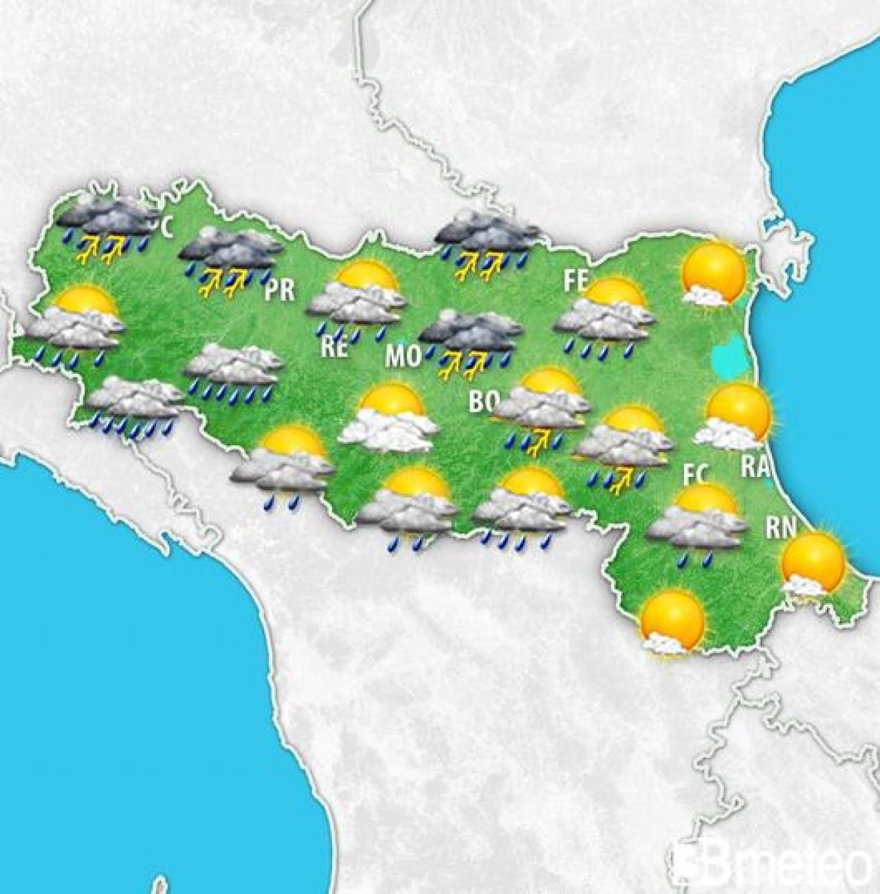
A low pressure vortex will slowly move from the Tyrrhenian Sea towards Central Italy in the first days of the week, maintaining conditions of marked instability in our region. Rain, thunderstorms, local hail and storms will not provide respite until the end of Tuesday, with more intense phenomena in the central-western areas. After a Monday even the day is unstable or disturbed Tuesday will not be outdone, with further rainfall accumulations which over the course of 24 hours could reach 50mm in the Parma area, 40mm in the Piacenza area, 25mm in the province of Modena, 20mm in the Bologna area, 10/15mm in Ferrara and Cesena, around 5mm in the areas of Ravenna, Forlì and Rimini. Maximum temperatures will fluctuate from 21/23°C in the western provinces to 25/27°C in the eastern ones. Wednesday, with the removal of the low pressure vortex towards the Balkans, the instability will begin to reduce, the clear spaces will increase and the daytime temperatures will increase by a few degrees, even if in the afternoon-evening some local thunderstorms moving from the Apennine areas will be possible towards Romagna. From Thursday the establishment of a high pressure promontory over the central Mediterranean and Italy will favor a further improvement, with mostly sunny conditions and maximum temperatures that may even exceed 30°C. For all the details enter the section Weather Emilia Romagna.


