The weather, after an overall pleasant Saturday especially in the afternoon hours although certainly cooler and with rough seas on the coast, is about to give way to a Sunday which will see the entry onto the scene of a depression arriving from northern Europe and which will then determine the isolation of a minimum (cut off) which will guarantee instability for a few days.
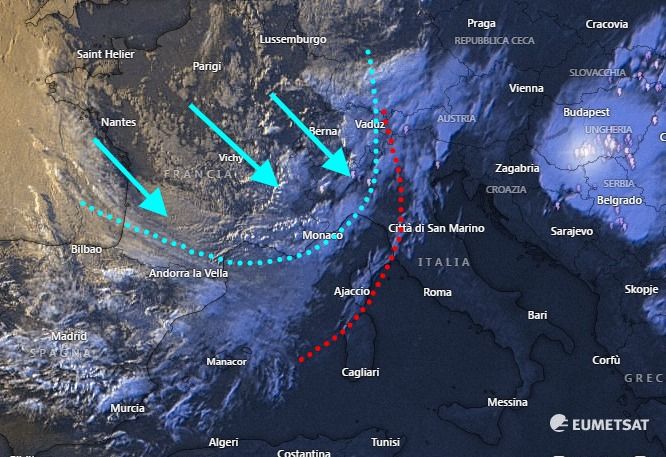
The entry of the cold air which has already reached the Alpine area and which in the next few hours will also flow into the Ligurian and northern Tyrrhenian Seas is clearly evident in the image below.
FIRST RAINS IN THE NIGHT
The first effects of the bad weather will begin to be felt in the next few hours at night rain expected especially on the coastal strip, more likely from Piombino towards the north.
Rain which will then spread across a large part of Tuscany tomorrow morning and could even be thunderstorms.
In this regard, a warning for strong thunderstorms is in effect from tomorrow morning until the end of the day.
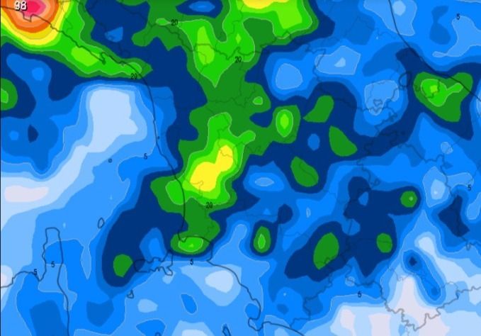
Below is a possible distribution of precipitation throughout Sunday.
Ultimately, therefore, a Sunday that we could define as unstable with disturbed sections that will give little to some sunnier breaks.
In addition to this, a further drop in temperatures is also expected which will quickly fall below the average for the period.
For all real-time reports, news and to send us your photos, subscribe to our official telegram group, we are waiting for you!
https://t.me/+1kcB3gY_R4QzNDhk
Or subscribe to the channel to always be informed!
https://t.me/meteotoscana


