
reading time
2 minutes, 6 seconds
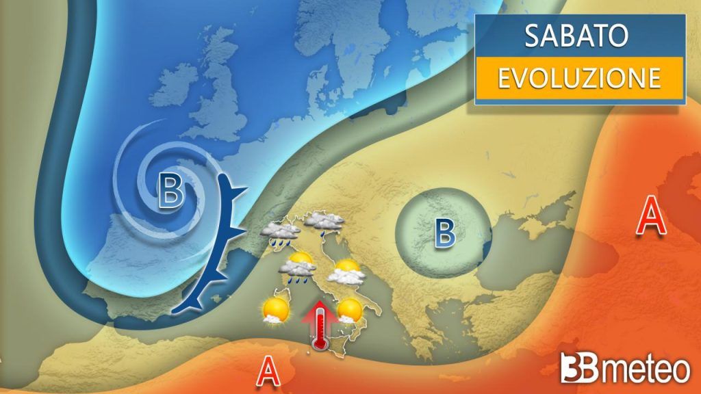
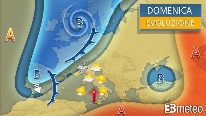
The flow of arctic currents which has heavily penalized Central Europe and Italy over the last two weeks change direction and points towards the western sector. This deviation involves a general reorganization of the depression structure that is being organized between the Iberian Peninsula and England calling back on the central Mediterranean basin warmer currents with an anticyclonic matrix. Italy however, it does not fully fall within the anticyclonic design, especially on this Saturday because still exposed to the humid flow Atlantic associated with sagging. It follows a thick time cloudy in the North and in part of the Center with still some rain and thunderstorms while in the South the situation has already largely improved. During the day of Sunday the vortex on the Bay of Biscay will rise in latitude towards England favoring a further increase in pressure on Italy but once again with the north-western regions that we will continue to see clouds and showers. At the same time the Atlantic trough will abandon a minimum on the Alboran Sea which will have an important story on Italy’s weather during the May 1st long weekend. But let’s see how this weekend goes:
SATURDAY WEATHER NEXT HOURS: North, cloudy or very cloudy with few openings. Rain and showers will be more likely between the North-West and Lombardy but at times they will also affect the North-East and Emilia albeit in a more isolated form. Snow in the Alps from 1500/1700m. Center, irregular cloud cover over Tuscany with the possibility of rain and local showers, more likely in the northern sectors. Elsewhere scattered clouds and clear spells with prevailing sun. Southmostly clear or slightly cloudy with some harmless haze or passing stratification. Temperatures increase in general, more sensitive in the South. Winds at times strong siroccals on the western basins, weak siroccals elsewhere. Marithe western basins are very moved, the others are little moved or moved.
SUNDAY WEATHER: North, very cloudy between Piedmont and upper western Lombardy with rain and showers, even moderate. More openings in Liguria with some rain possible in the west. Slightly or partly cloudy elsewhere with prevailing sunshine. Centerclear or partly cloudy with some medium-other stratified clouds, thicker at times over Tuscany. Southclear or slightly cloudy. Temperatures further increasing. Winds sirocco, also theses on Sardinia and the Ligurian Sea. Mari the western basins are very moved, the others are little moved or moved.
Do you want to know if and when it will rain in your area? Discover the section dedicated to rainfall maps >> Here.
When it rains there are some extra precautions to take when driving, such as checking the correct tire pressure. >> Here.


