

reading time
54 seconds
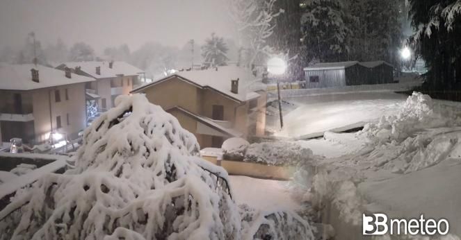
After a weekend characterized by a marked instability with a cold matrix, the week will begin with a further step back in the season spring which will leave ample margin for expression to a phase more typically winter. The Arctic air entering the Mediterranean from the Rhone Valley will stimulate the formation of a depression vortex which will keep temperatures very low and bring abundant rainfall to the Center and North. Precipitation that will be nevosed at unusually low altitudes for the period. In particular Monday morning favorable conditions for snowfall may occur even below 400m to the North-West and at medium or high hill levels on the Tuscan-Emilian ridge, also the city of Wedge it will be whitewashed.
During Monday the snow level will rise slightly and snowfall will also tend to affect the Northeast at levels around 800/900m. Also on Tuesday there may be some snowfall but at higher altitudes, but locally still below 1000m on the northern Apennine ridge and the western Alps.
Do you want to know if and when it will rain in your area? Discover the section dedicated to rainfall maps >> Here.
Gelicidio, Brina, Galaverna and Calabrosa, in some cases are real dangers in winter. Let’s see what they are and how they are formed >> Here.


