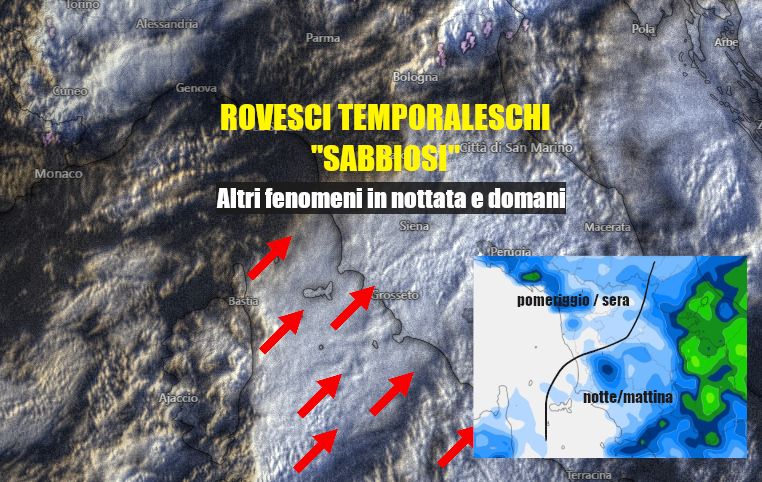
TUSCANY WEATHER. Compact clouds are moving rapidly from Corsica and Sardinia also towards Tuscany, especially the southern part.
On the border with Lazio, thunderstorms are in action, characterized by heavy showers and heavy sand loads.
In the next night hours, central and southern Tuscany will still be the ones to feel the most of this humid influx which could bring other scattered precipitations that will tend to move also towards the Arezzo and Florentine Apennines.
Thunderstorms will still be possible without excluding the risk of local manifestations of moderate or strong intensity as already contemplated in the weather watch notice already reported.
For tomorrow we report a greater risk of phenomena in the second part of the day in the north of the Region:
Also from tomorrow a further drop in temperatures is expected due to the arrival of cooler air from the west which, among other things, will tend to sweep away more effectively the sandy dust still present in the atmosphere.
Other unstable possibilities will have to be evaluated for Wednesday.
