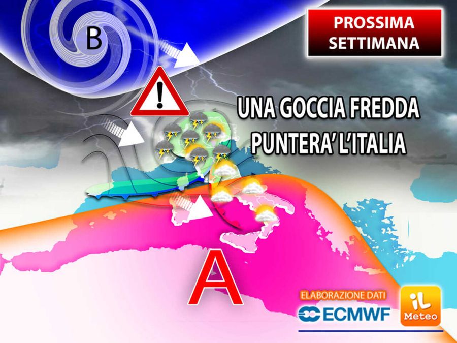
Over the next week a “cold drop” from Northern Europe will break into the Mediterranean basin: turbulent days await us with lots of rain and thunderstorms in at least half of Italy.
But what is it? At high latitudes, currents flow (colder and unstable) that are very different from those that pass at lower latitudes (very warm and stable) and the heat exchanges between Northern and Southern Europe in particular conditions can evolve, in fact, into a cold dropor in a block of cold air at altitude which detaches itself from a larger Atlantic or Northern European depression. In short, an area of the atmosphere where it is much colder than all the surrounding areas. This nucleus, driven by unstable currents, tends to follow trajectories that are not always predictable and often takes a retrograde direction (from east to west).
According to the latest updates, already in starting next weekduring the days of Monday 24th and Tuesday 25th June, this particular weather pattern will begin to have its effects felt on Italy too. Given the strong thermal and hygrometric contrasts expected, the greatest danger would concern, according to current data, the regions of Central-North: the incoming fresh currents could act as a trigger for the genesis on these sectors of violent stormswith high risk of hail and premises storms as unfortunately the recent news of recent years teaches us.
Given the unpredictability of this “unstable spinning top”, it is possible that in the next few days the forecast of its direction may change and that subsequent storms may affect different or larger areas. Wednesday 26 June we then expect the last storms in the North and on the Adriatic coast.

