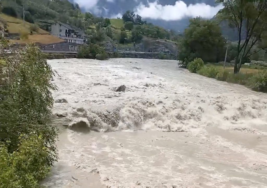
It rises to orange, in the bulletin issued at 1.46 pm today, Friday 21 Junethe alert in the lower valley regarding the Dora Baltea. In the rest of the regional territory, the yellow alert remains in place for slopes and streams, with warnings for thunderstorms. The new bulletin is valid until 11.59pm tomorrow, Saturday 22 June, when it will be updated at 2pm.
As regards the hydrogeological situation, the “effects linked to the melting of the snow and the contribution of precipitation will lead to a rise in levels, with local flooding both on the Dora (mainly in grassland areas or with non-permanent anthropic activities) and on the lateral streams (where the involvement, locally, of inhabited centers is not excluded), again for the next few hours, and then decrease during the afternoon”.
Due to the saturation of the waterways, the bulletin continues, “possible rock falls and superficial landslides, causing temporary interruptions to traffic and localized damage to infrastructure”. For tomorrow, Saturday, “residual instability phenomena are expected due to soil saturation and lower levels but still close to the warning thresholds”.
Regarding the meteorological situation, the bulletin highlights that “a minimum brings precipitation in the form of showers for today: the most intense part, linked to the front, ends in the morning/central hours, but a ‘tail’ of instability passes this afternoon, with generally weak showers, but with considerable uncertainty locally moderate or strong and localized phenomena cannot be excluded”.
From 3pm to 6pm today, Friday 21 June, according to the Civil Protection, “between 5-8 mm on average and 15-20 mm maximum fell in all areas; a little more intense in the south-eastern and north-western sectors. The levels are still above the warning thresholds, slightly decreasing in some sections“. “Residual storms are still expected until late in the evening and the phenomena will end during the night”. In the late afternoon, a “local flooding of the Dora in Bard was recorded, at km 55 on state road 26” and, otherwise, “there are no further critical situations caused by bad weather compared to those” that have already emerged.
Bad weather, the municipal road between Champdepraz and Montjovet is closed
June 21, 2024 – 12.31 pm
Due to a series of water infiltrations from the Dora Balteawas closed municipal road between the municipalities of Champdepraz and Montjovet.
The closure affects the section that goes from the motorway underpass to the roundabout in the Loriaz district. To communicate it Department of Civil Protection and the Body of Fire fighters.
Civil Protection: be careful along the Dora di Valgrisenche
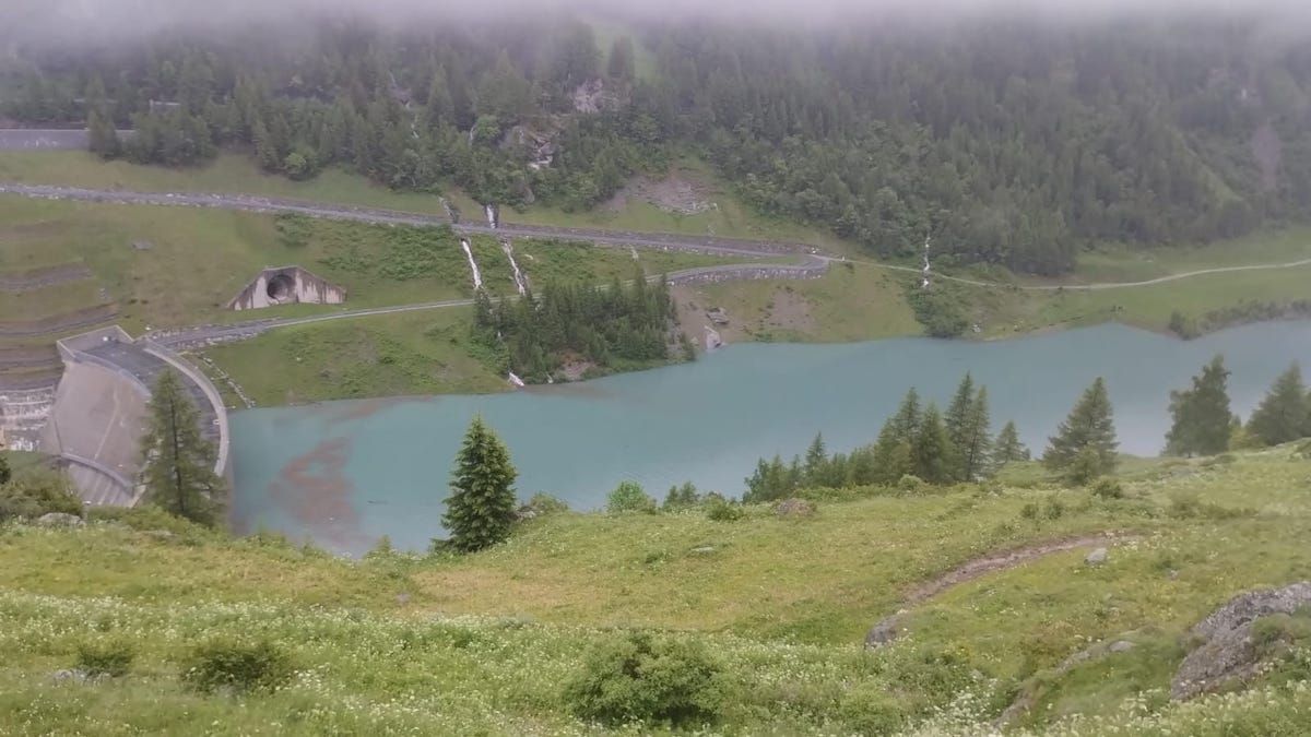
The precipitation of the last 24 hours, combined with the snow melt, have done so reach the maximum regulation level of the Beauregard Dam. The plant then began to touch the natural flows arriving in the basin in the Dora di Valgrisenche.
There are no critical issues at the moment – informs the Civil Protection and Fire Brigade Department – but you are asked to pay maximum attention along the banks of the stream. The staff of the Municipality of Valgrisenche and the Valle d’Aosta Forestry Corps have been activated to monitor potentially critical points.
The situation in the rest of the region
Since the start of the rainfall, which began the day before yesterday, Wednesday 19 June – says the Region’s Functional Center – “averages of around 20 mm have been recorded in areas A and B (centre and lower valley, ed.) and around 40 mm in C and D (upper valley and valleys of the southern border, ed.)”. The station that recorded the most precipitation is Cogne Valnontey, with approximately 56 mm.
The only disruption that has occurred since the start of the disturbance is that of the landslide that blocked the regional road in Val di Rhêmes, “which occurred approximately at 4 in the morning yesterday”, with the road reopening a few hours later. “No flooding was recorded and the levels of the waterways, also due to the melting of the snow, which is still very present at high altitude, are increasing”, we read in the update dated 9.55am today.
The exceeding of the first warning threshold occurred “in Hône, Champdepraz, Pontey, Aymavilles, Valsavarenche Eaux-Rousses and Gressoney-Saint-Jean. – underline from the Functional Center – The levels are however well below the flood thresholds”.
As for the weather forecast for today, with the yellow alert remaining until midnight, “openings of cloud cover are expected in the eastern and SE sectors in the afternoon, but a second disturbed passage mainly affects the Western sectorswith localized phenomena also in the form of thunderstorms, with lower accumulation in the 12 hours compared to this morning”.

