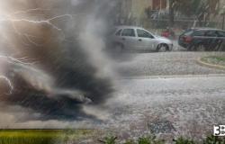
A cyclonic vortex fed by cold winds arriving from the distant lands of the Arctic will move its center of gravity towards the east, maintaining favorable conditions for scattered rain, thunderstorms and hailstorms.
What are the regions where it will be essential to have an umbrella on hand? Starting from the North, in the next few hours An improvement in atmospheric conditions is expected in the western regions, where the sun will reappear bringing with it a milder climate. However, the situation will remain unstable in the North-East, with even moderate rainfall which will tend to gradually decrease between the afternoon and evening with even some partial openings. The snowfall they will affect the Dolomites at relatively low altitudes and the Emilian Apennines, with accumulations around 900/1000 meters above sea level.
Continuing towards the Center, the day will be decidedly unstable: showers of rain and possible temporal they will be able to affect almost all regions, including Sardinia. THE thunder showersalthough distributed in a very irregular and unpredictable manner, may locally be of strong intensity, increasing the risk of hailstorms. Despite this, there will also be long dry breaks accompanied by temporary clearings. It is important to also pay attention to snowwhich could fall on the Apennines at altitudes around 1000 meters.
Concluding with the South, the influence of the cyclonic vortex will be only partial. The meteorological situation will be characterized by variable cloud cover and some rain, especially on the Tyrrhenian coasts of Campania and Calabria, as well as in the surrounding areas. Sicily will also be affected by some rainfall. The other regions of the South will experience a variable context with generous sunny spells alternating with the passage of moderate cloud cover.
CIVIL PROTECTION ALERT
Based on available forecasts, the Department of Civil Protection in agreement with the regions involved, who are responsible for activating the civil protection systems in the territories concerned, issued a warning of adverse weather conditions. The weather phenomena, impacting the different areas of the country, could determine hydrogeological and hydraulic criticalities which are reported, in a national summary, in the national criticality and alert bulletin which can be consulted on the Department’s website (www.protezionecivile.gov.it).
For this reason, as stated on the company website Civil protectionfor the day of Wednesday 24 April has been issued a yellow weather warning for risk temporal, hydraulic risk and hydrogeological riskor in some areas of Central and Southern Italy. Specifically, it will yellow alert in Lazio, Campania, Calabria and Basilicatto.
According to what was communicated by Civil protectionthe sectors affected by the weather warning Wednesday 24th Aprilare the following:
Ordinary criticality due to hydraulic risk / yellow alert:
Calabria: Northern Tyrrhenian Slope, Central-Northern Tyrrhenian Slope
Ordinary criticality due to storm risk / yellow alert:
Basilicata: Bases-D
Calabria: Northern Tyrrhenian Slope, Central-Northern Tyrrhenian Slope
Campania: Lower Cilento, Upper Volturno and Matese, Campania Plain, Naples, Islands and Vesuvian Area, Sorrento-Amalfi Peninsula, Sarno Mountains and Picentini Mountains, Tusciano and Alto Sele, Sele Plain and Alto Cilento
Ordinary criticality due to hydrogeological risk/yellow alert:
Calabria: Northern Tyrrhenian Slope, Central-Northern Tyrrhenian Slope
Lazio: Basins of RomeRieti Apennines, Middle Tiber Basin, Northern Coastal Basins, Liri Basin, Southern Coastal Basins, Aniene
Tags: Arctic cyclone moving lets thunderstorms hail snow hit


