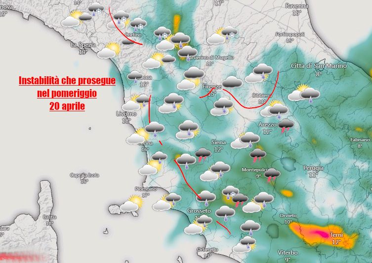
TUSCANY WEATHER. Wet awakening for some areas of the province of Pisa, Livorno and Siena due to a cloud body moving from north to south which was also associated with scattered lightning strikes.
In the next few hours the trend will still be characterized by a general instability which will have its maximum effects towards mid-afternoon with the arrival of further rain and showers especially in central-southern Tuscany, close to the Apennines but also in the areas adjacent to the coast.
The showers may still take on a thunderstorm character and be accompanied by local episodes of hail. Snow showers expected at high altitude as already indicated in the previous forecast.
Temperatures below average, maximums several degrees below seasonal averages.
Tendency to improve during the late evening and early hours of the night.
SUNDAY currently confirmed a quieter but cold start in the morning but with increasing clouds over the northern region due to the arrival of another disturbed pulse.
For all real-time reports, news and to send us your photos, subscribe to our official telegram group, we are waiting for you!
https://t.me/+1kcB3gY_R4QzNDhk
Or subscribe to the channel to always be informed!
https://t.me/meteotoscana
Tags: SHOWERS MORNING ARRIVE INSTABILITY

