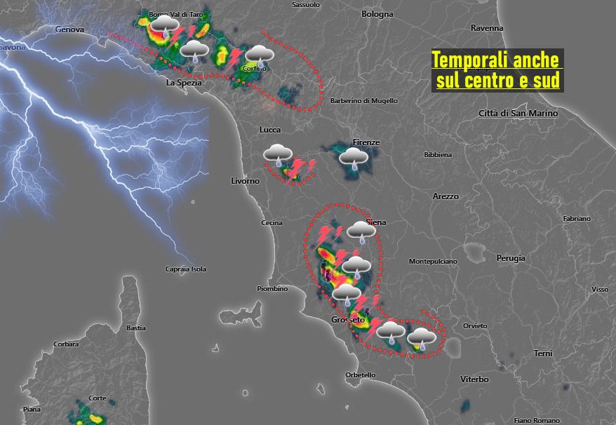
TUSCANY WEATHER. The instability that was expected to be more active today in northern Tuscany did not fail to manifest itself already from mid-day. Thunder and showers affected both the Province of Massa Carrara and that of Lucca with greater presence of thunderstorms on the eastern slopes of the Apuan Alps.
The northern wind initially moved the Garfagnana clouds even further south.
There are also significant rainfall nuclei recorded in the north of the province of Grosseto (internal areas) where a cell has been in action since the early afternoon hours.
Cumulus clouds are also moving across the Pisa area with showers north of Pontedera (without lightning).
Instability which therefore proved to be a little more present than expected with a more defined evolution not only in the north of the region, this due to the entry of colder air arriving from the north.
By the evening we will have a more decisive improvement under the push of north-westerly winds which will be associated with a drop in temperatures.
New thunderstorms, probably more widespread, are expected for tomorrow.
For all real-time reports, news and to send us your photos, subscribe to our official telegram group, we are waiting for you!
https://t.me/+1kcB3gY_R4QzNDhk
Or subscribe to the channel to always be informed!
https://t.me/meteotoscana


